Failed Islamic States in Senegambia
David Robinson
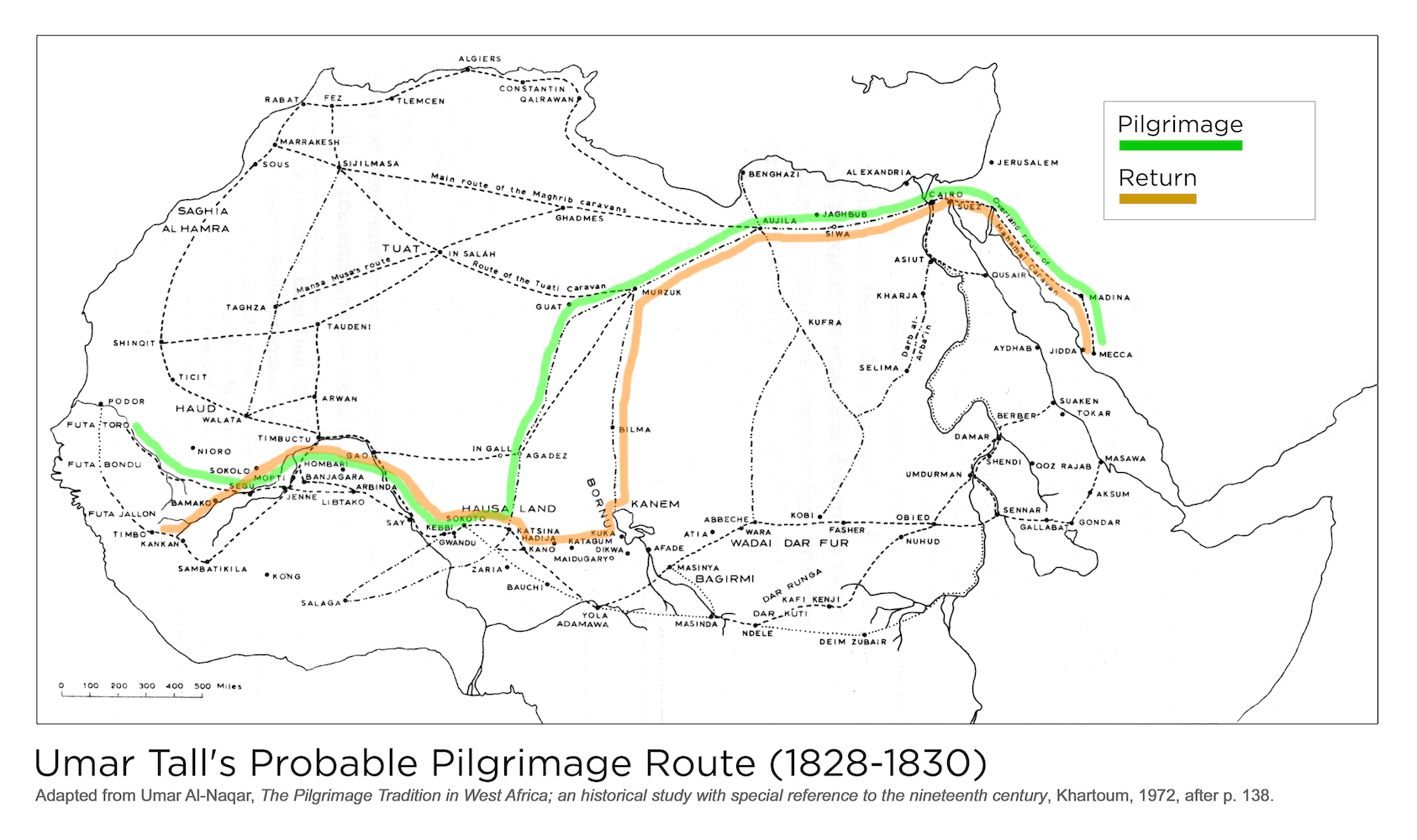
Umar Tall's Probable Pilgrimage Route (1828-1830)
Creator: Robinson, David
Jaquint, Daniel
Al-Naqar, 'Umar
Jaquint, Daniel
Al-Naqar, 'Umar
Contributing Institutions: David Robinson; Daniel Jaquint; 'Umar Al-Naqar; MATRIX: The Center for Humane Arts, Letters, and Social Sciences Online at Michigan State University
Description: Umar al-Naqar sought to sketch out the main routes by which West Africans journeyed to and from the pilgrimage. The distances were immense, and it was important to join up with other pilgrims and caravans to make the journey, which often took several years. From Umar's own writings, we have sketched out his probable routes going and coming. He made the pilgrimage in three successive years, 1828-30, and so would have been traveling for much of 1827 (going) and 1831 (returning). This new map was made in 1972. This map contains the following captions, "Umar Tall's Probable Pilgrimage Route (1828-1830)" "Algiers" "Rabat" "Fez" "Tlemcen" "Constantin" "Qairawan" "Marrakesh" "Sijilmasa" "Main route of the Maghrib caravans" "Ghadmes" "Sous" "Saghia Al Hamra" "Tuat" "In Salah" "Mansa Musa's route" "Taghza" "Shinqit" "Taudeni" "Ticit" "Haud" "Walata" "Timbuctu" "Arwan" "Podor" "Futa Toro" "Futa Bondu" "Futa Jallon" "Timbo" "Kankan" "Sambatikila" "Bamako" "Kong" "Niono" "Sokolo" "Mopti" "Segu" "Banjagara" "Hombahi" "Gao" "Arbinda" "Say" "Kebbi" "Gwandu" "Sokoto" "Hausa land" "In Gall" "Agadez" "Guat" "Route of the Tuati caravan" "Murzuk" "Katsina" "Hadija" "Kano" "Zaria" "Bauchi" "Yola Adamawa" "Maidugaryo" "Dikwa" "Katagum" "Kuka" "Bornu" "Kanem" "Bilma" "Murzuk" "Aujila" "Jaghbub" "Siwa" "Benghazi" "Alexandria" "Cairo" Jerusalem" "Suez" "Overland route of Mahamal caravan" "Madina" Mecca" "Jidda" "Asiut" "Qusair" "Kharja" "Kufra" "Darb Al-Arba'in" "Selima" "Afade" "Atia" "Masinya" "Bagirmi" "Masinda" "Ndele" "Dar Kuti" "Deim Zubair" "Dar Runga" "Atia" Abbeche" "Wara" "Wadai Dar Fur" "Kobi" "Fasher" "Obied" "Nuhud" "Kafi" Kenji" "Umdurman" "Damar" "Berber" "Aydhab" "Suaken" "Tokar" "Shendi" "Goz Rajab" "Masawa" "Aksum" "Sennar" "Gallabat" "Gondar"
Date: 1972
Date Range: 1970-1979
Location: Senegal
Format: Image/jpeg
Rights Management: For educational use only.
Digitizer: MATRIX
Source: Adapted from 'Umar Al-Naqar, The Pilgrimage Tradition in West Africa; an historical study with special reference to the nineteenth century, Khartoum, 1972, after p. 138.

 click image to zoom


