Saint-Louis: Religious Pluralism in the Heart of Senegal
by David Robinson with assistance from Ghislaine Lydon, Kalala Ngalamulume and others
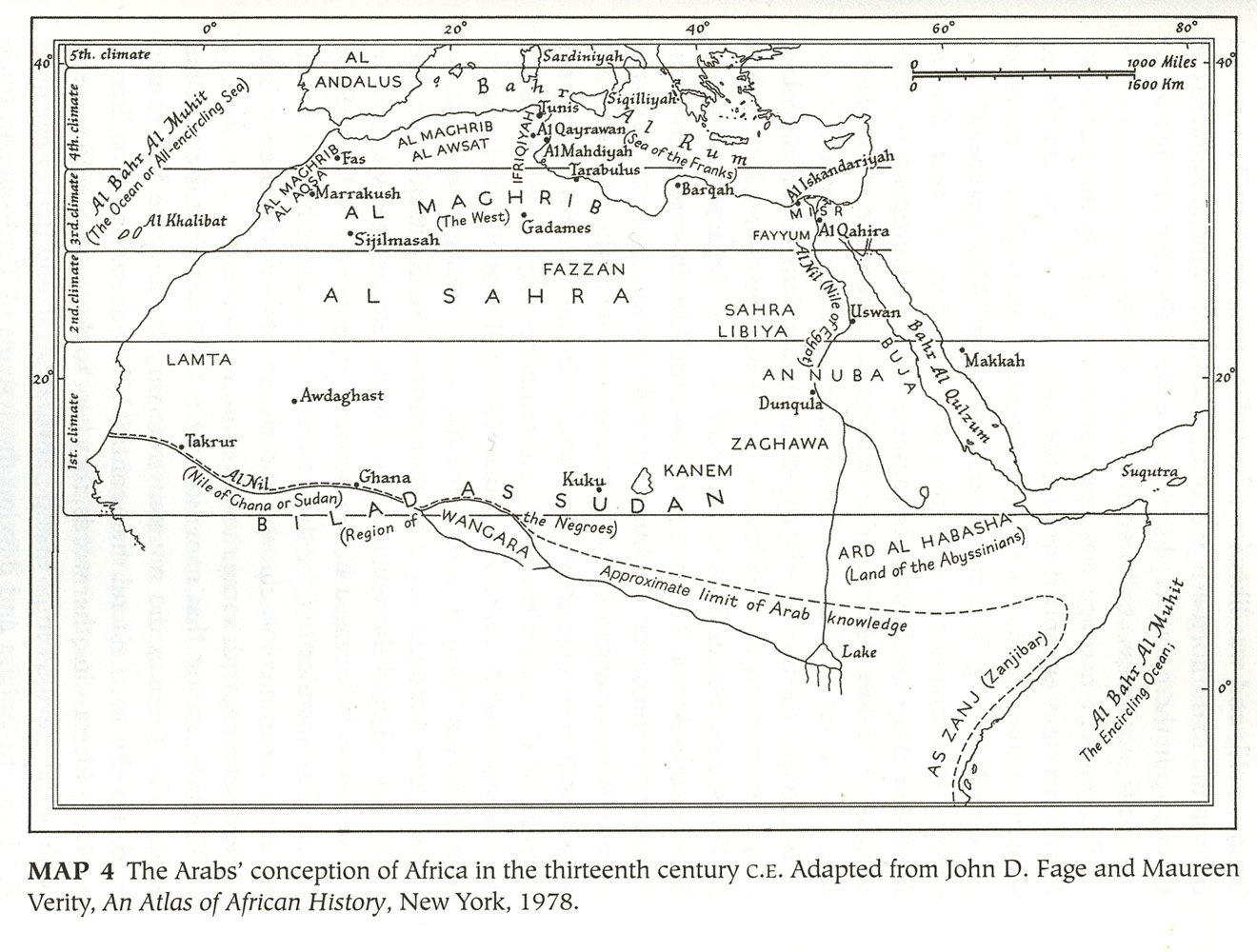
The Arabs' conception of Africa in the thirteenth century C.E.
 click image to zoom
Description: This mental map, based on Arab conceptions of the Mediterranean and Africa, correlates the descending southern climes of Africa with greater heat and diminished civilization. It created the framework for racial and cultural prejudice, and was very present in the 19th and 20th century conceptions of "white" or bidan societies as they thought of the "blacks" or sudan living in Senegal and other areas to the south. This map contains the following captions, "Map 4 - The Arabs' conception of Africa in the thirteenth century C.E. Adapted from John D. Fage and Maureen Verity, An Atlas of African History, New York, 1978." "5th climate" "Al Bahr Al Muhit (The Ocean or All-Encircling Sea)" "Al Maghrib" "Al Aosa" "Ifriqiyah" "Sardiniyah" "Al Andalus" "Bahr Al Rum (Sea of the Franks)" "Fas" "Al Maghrib" "Al Aswat" "Tunis" "AL Qayrawan" "Al Mahdiyah" "Siqilliyah" "4th climate" "Al Khalibat" "Marrakush" "Al Maghrib (The West)" "Sijilmasah" "Gadames" "Barqah" "Al Iskandariyah" "Misr" "Fayyum" "Al Qahira" "3rd climate" "Al Sahra" "Fazzan" "Sahra" "Libiya" "Al Nil (Nile of Egypt)" "Uswan" "2nd climate" "Lamta" "Awdaghast" "Takrur" "Al Nil (Nile of Ghana or Sudan)" "Ghana" "Bilad As Sudan (Region of the Negroes)" "Kuku" "Kanem" "Buja" "An Nuba" "Dunqula" "Zaghawa" "Bahr Al Qulzum" "Makkah" "Suqutra" "1st climate" "Wangara" "Ard Al Habasha (Land of the Abyssinians)" "Approximate limit of Arab knowledge" "Lake" "As Zanj (Zanjibar)" "Al Bahr Al Muhit (The Encircling Ocean)"
Date Range: 1970-1979
Format: Image/jpeg
Rights Management: For educational use only.
Contributing Institution: David Robinson; MATRIX: The Center for Humane Arts, Letters, and Social Sciences Online at Michigan State University
Digitizer: MATRIX
Source: Adapted from John D. Fage and Maureen Verity, An Atlas of African History (New York, 1978) and used in David Robinson Muslim Societies in African History (Cambridge, Cambridge University Press, 2004). Page 75.


